 Live Radio
![]() As researchers are able to locate ever smaller earthquake fault-lines across California, they have more of them to add to the state’s newly updated geological maps.
As researchers are able to locate ever smaller earthquake fault-lines across California, they have more of them to add to the state’s newly updated geological maps.
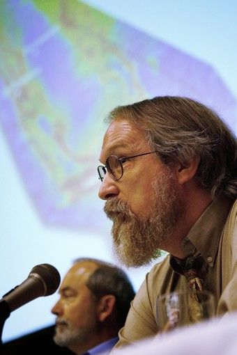 Ongoing research develops new information that is incorporated into the updated fault-line maps, says Chris Wills (foreground at right) of the California Geological Survey in Sacramento. Often that means adding new faults or changing the length of others that have been known for many years. But there are also infrequent cases where previously mapped faults are deleted.
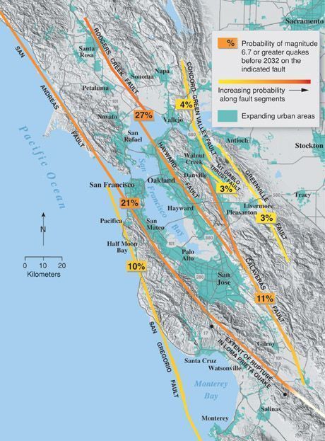 Use this link to see the interactive map of recent fault activity. The new online maps give users considerable flexibility in how they view the information. Wills has some tips for getting the most out of them.
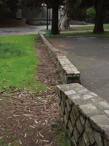 Faultlines lie on the earth’s surface, but they are mostly visible to the trained geologist’s eye. But instances of what is known as “surface creep,” where one side of the fault is moving away from the other, provide distinctive clues, Wills says. If you know what to look for.
In Hayward's Memorial Park, this 1930s wall has been noticeably offset by fault creep. Photo by John Karachewski.
